2022. April 06.
The Find-GCP program, developed in the department's Geo4All lab, became an official project of OpenDroneMap. Find-GCP is a tool to find special ArUco markers on images made by UAVs.
Find-GCP is an open-source project available on the GitHub portal; its development began two years ago.
Students and volunteers are welcome to join the development and testing.
OpenDroneMap is the most popular, open-source photogrammetric software package for processing UAV images.
Geo4All is an international lab network that aims to integrate open-source GIS software into education and research.
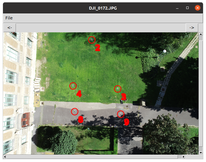
Original image and detected ArUco markers